Category Archives: Favorite Trails

Favorite Trails: Grotto Falls

Favorite Trails: Grotto Falls

Trail to Grotto Falls © William Britten use with permission only

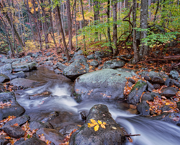
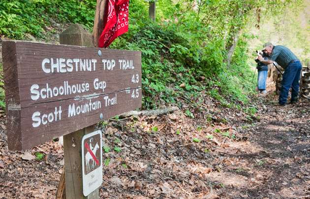
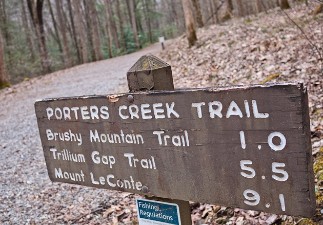
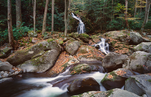
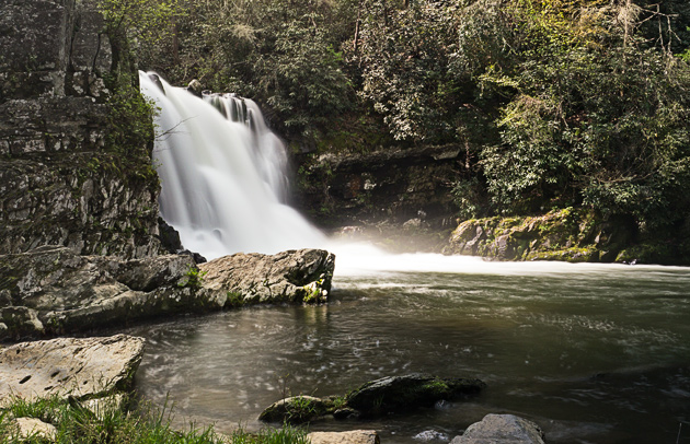
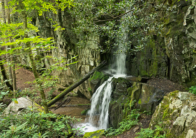
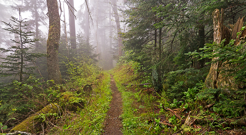
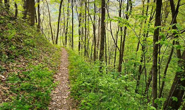
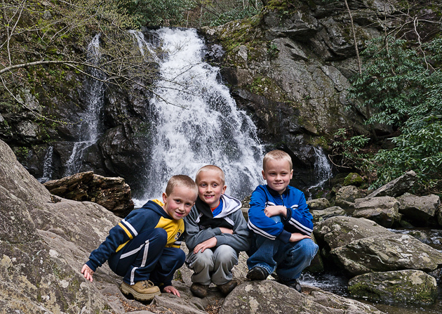
The route to Grotto Falls is one of the sweetest Smoky Mountains waterfalls hikes.  Not much more than a mile in length, this hike has a gem at the end, with many opportunities for photos.  As the sign above indicates, it’s a part of the Trillium Gap Trail which goes on up to Mt. LeConte.  The hike starts from a parking area along the Roaring Fork Motor Trail (stoplight number 8 in Gatlinburg).

Behind the waterfall
Behind the waterfall © William Britten use with permission only

I hiked up to the waterfall in late November, just before the Roaring Fork Motor loop closed for the winter. Grotto Falls is especially nifty because the trail goes behind the falls, as seen in the photos above and below. And an added bonus, the llama pack train that carries supplies to LeConte Lodge can be seen on the trail every Monday, Wednesday and Friday … leaving at dawn and returning sometime between 3:00 and 5:00.

Llamas on the trail
Llamas on the trail © William Britten use with permission only

Please stop in and visit me out on the Arts and Crafts Loop along Glades Road to see the complete display of photos of Smoky Mountains scenes at the William Britten Gallery in Gatlinburg, TN.

Favorite Trails: Lynn Camp Prong

Favorite Trails: Lynn Camp Prong

Lynn Camp Prong © William Britten use with permission only

Lynn Camp gets its name from a logging camp of the Little River Lumber Company in the 1920s. The old railroad trace provides a wide, flat path that is popular for horseback riding.

I love to walk along the old railroad grade beside the Lynn Camp Prong in the Great Smoky Mountains National Park. It’s especially attractive in autumn, but any season is worth the trip.  From Gatlinburg, take the Little River Road towards Cades Cove. Just past the Townsend Y, turn left into the Tremont area. Keep going straight, the road will turn to gravel and end with a parking area for the trail.  Cross over the footbridge and take the trail to the left.

Several of my favorite images were taken along the Lynn Camp, including Smoky Mountain Monet and Smoky Mountain Magic.

Please stop in and visit me to see the complete display of Smoky Mountain Photography at the William Britten Gallery in Gatlinburg, TN.

Wildflower Trails: Chestnut Top Trail

Wildflower Trails: Chestnut Top Trail

Chestnut Top Trail © William Britten use with permission only

Just a hundred yards north of the Townsend Wye is a parking lot, and across the road is the start of the Chestnut Top Trail. In spring this is one of the premier Smoky Mountains wildflowers hikes, with opportunities for photos every few feet! The trail cuts into a steep embankment, climbing steadily for the first half-mile or so. It is this part of the hike that is packed with a huge assortment of flowers. Hike the trail often during late March and April, and you will see plenty of Trilliums. Fire Pink, Star Chickweed, Trailing Arbutus, Crested Dwarf Iris, Squawroot, Spring Beauty, Bishops Cap, Foamflower, Stonecrop, and many more. How’s that for name-dropping?

Another nice thing about Chestnut Top Trail is that the steep bank puts many of the blooms almost at eye level on the upper side of the hill, which sets them up nicely for photos.

As you climb the steep hill, the Little River runs north below you, and eventually you can spot the fields of Tuckaleechee Cove.

Please stop in and visit me to see the complete display of wildflowers and landscape photos of the Smoky Mountains at the William Britten Gallery in Gatlinburg, TN.  And if you are a facebook user, please “Like” either of the two pages shown on the panel to the right. On the Wildflowers Community page we share photos, bloom locations, and other tips.

Crested Dwarf Iris © William Britten use with permission only

Favorite Trails: Porters Creek

Favorite Trails: Porters Creek

Porters Creek Trail © William Britten use with permission only
Porters Creek trailhead © William Britten use with permission only

Porters Creek Trail is a delightful meander in the Greenbrier section of the Smoky Mountains. Head east out of Gatlinburg on Route 321, then after about 6 miles, the Greenbrier entrance will be on the right. Eventually the road will turn to gravel and you’ll pass the bridge to the Ramsay Cascades Trail. Continue straight ahead until the road finally dead-ends at the trailhead parking lot. The trail follows Porters Creek for most of the way, and as you can see from the sign it is one of the many trails leading to the summit of Mt. LeConte.

rters Creek in the Smoky Mountains
Porters Creek
Smoky Mountain footbridge
Porters Creek Trail footbridge

The first mile of the trail is a well maintained jeep road with an easy walking grade. Along the way are many opportunities to slow you down and take photos. Watch to the right for many signs of pioneer homesteads. There are rock walls, chimneys, house foundations, and even a primitive cemetery.
These echoes of early settler life in the Smoky Mountains testify to the harsh realities of scraping a life out of rugged and isolated terrain.

Rock wall in the Smoky Mountains
Rock wall remnant from pioneer days
Stone steps
Rock steps from pioneer homestead
Smoky Mountain cemetery

In April the Porters Creek Trail becomes one of the the best wildflower hikes in the Smokies.

White Trillium © William Britten use with permission only

For a nice two-mile round-trip hike, continue on up the trail and bear to the right when the jeep road enters a turnaround. At this point you can take a short side-trail over to visit a small group of log buildings, including the John Messer barn, which was built around 1875, and the Smoky Mountain Hiking Club cabin, which was constructed from 1934-36.

Please stop in and visit me to see the complete display of photos of the Smoky Mountains at the William Britten Gallery in Gatlinburg, TN. If you are a Facebook user, you can get my daily Smoky Mountains news and photos by becoming a fan of the William Britten Photography Facebook Page.

Pioneer barn © William Britten use with permission only
John Messer Barn © William Britten use with permission only
Smoky Mountain Hiking Club cabin © William Britten use with permission only
Favorite Trails: Big Creek to Midnight Hole and Mouse Creek Falls

Favorite Trails: Big Creek to Midnight Hole and Mouse Creek Falls

Waterfalls photos: Midnight Hole
Waterfalls photos: Midnight Hole © William Britten use with permission only

One of my favorite Smoky Mountains hikes is in the Big Creek section of the National Park, located on the eastern side, with the easiest access being from Interstate 40. Take the Waterville exit (451), which is the last Tennessee exit going east. Proceed through a hydroelectric plant, crossing into North Carolina, through a four-way rural intersection and into the Park. There is a campground and picnic area as well as excellent hiking. This area was heavily timbered in the early part of the 20th century, and as a result, the trail is a wide berm with an easy grade created to remove the trees with a rail line. This hike features two fine waterfalls!

About a mile up the trail you’ll pass a jumble of huge boulders known as Rock House.  Another half mile up the stream is Midnight Hole, which is one of the most picturesque waterfalls in the Smoky Mountains.  It flows into a deep green pool that gives the waterfall it’s name. Be careful not to miss the short side-trail that detours over to the bottom of the falls. It’s an excellent swimming area in summer, and as you can see from the picture, a beautiful spot in the fall. This is a good hike any time of year.

The picture to the left is one of my Featured Photos, and is a perennial best-seller.

But don’t stop now!  Another half-mile up the trail is a second gem, where Mouse Creek plunges dramatically down a steep hillside and into the creek. This is another great spot in the fall, and the boulders will beckon you to sit down and eat your trail mix, take some photos, or just meditate on the wonder of it all.

Smoky Mountains waterfalls: Mouse Creek
Smoky Mountains waterfalls: Mouse Creek © William Britten use with permission only

If you continue on for several hundred yards, there is a footbridge that crosses Big Creek and another very attractive pool.

Please stop in and visit me to see the complete display photos of the Smoky Mountains at the William Britten Gallery in Gatlinburg, TN.

Favorite Trails: Abrams Falls

Favorite Trails: Abrams Falls

Trail to Abrams Falls
Trail to Abrams Falls © William Britten use with permission only

The trail to Abrams Falls is one of the most popular Smoky Mountains hikes. Get to the parking area at the western edge of Cades Cove early, and enjoy this easy-going hike before the crowds arrive! Abrams Creek and the waterfall are named after Chief Abram, leader of the Cherokees who lived at Chilhowee Village, near the mouth of Abrams Creek.

The trail follows Abrams Creek over a fairly easy course for about two and a half miles, starting at the footbridge pictured above. Midway, the trail climbs Arbutus Ridge, and from this point 200 feet above the creek, you can see how the stream makes an extreme loop through a gorge known as Big Horseshoe. The loop continues for nearly a mile, finally curving back on itself nearly to where it began, separated only by the lower end of Arbutus Ridge.

During the spring wildflower season, you will find Trailing Arbutus along this section of the trail, as well as Bleeding Hearts and Gay Wings.

At the waterfall there is a sign warning of the dangers risked by those who jump off the falls or swim near its strong currents. Apparently this didn’t stop Dutch Roth and his friends from diving off the cliffs back in the 1940s.

Smoky Mountains photos: Abrams Falls
Smoky Mountains photos: Abrams Falls © William Britten use with permission only

As always please stop in and say hello at the William Britten Gallery along the Historic Arts and Crafts Loop on Glades Rd. in Gatlinburg. My complete selection of Smoky Mountains photos, as well as mugs, notecards and magnets are all on display most days throughout the year.

Smoky Mountains photos: Abrams Falls
Smoky Mountains photos: Abrams Falls © William Britten use with permission only
A Short Walk to an Old Cemetery

A Short Walk to an Old Cemetery

Smoky Mountains History: Plemmons Cemetery
Smoky Mountains History: Plemmons Cemetery © William Britten use with permission only

We began our exploration of the False Gap area in the Greenbrier last week. To refresh our memory, this is the area just over the first two bridges as you turn to head up to Ramsey Cascades Trail. Park near the old road with a chain across it to your right. Today we will be taking the short half-mile walk up to Plemmons Cemetery.

The largest cemetery in the Greenbrier area of the Smoky Mountains, and one of the largest in the National Park, is the old Greenbrier Cemetery. After the formation of the Park, it became known as Plemmons Cemetery, named for David Plemmons, the preacher who lived in a home just up False Gap creek.

I spent an hour or so here walking respectfully among the graves, many of which are extremely old. The names here are mostly Whaley and Bohannon … two homesteading families with long histories that we’ll explore in some later blog posts. Some of the grave markers are little more than names and dates scratched onto rocks, such as in the photo at the bottom of the page. Others have been replaced with more modern granite markers.

The grave marker below is that of William Whaley, born in 1788 in North Carolina. William went off to war as a fifer in the War of 1812, and returned to live in the Smoky Mountains for another 62 years!  His brother Middleton settled further down the Little Pigeon River near Emerts Cove, which today is just outside the National Park boundary. 100’s of the Whaley ancestors lived in the Greenbrier for more than a century.

Plemmons Cemetery
Plemmons Cemetery © William Britten use with permission only

If you want to dive deeper into the history of the Greenbrier, and of the folks buried in Plemmons Cemetery, Mike Maples offers some incredible information, some of which I’ve borrowed for this blog post. Thanks Mike!

When you are ready for a break from your wanderings, please consider a stop at the William Britten Gallery on the Historic Arts and Crafts Loop on Glades Rd. in Gatlinburg, TN.  My complete display of Smoky Mountains photos might tempt you with a special memory to take home.

Old Gravestone in Plemmons Cemetery
Old Gravestone in Plemmons Cemetery © William Britten use with permission only
Favorite Trails: Baskins Falls

Favorite Trails: Baskins Falls

Baskins Falls
Baskins Falls © William Britten use with permission only

Baskins Falls is sandwiched in between two more famous Smoky Mountains waterfalls along the Roaring Fork Motor Trail: Rainbow Falls and Grotto Falls. For that reason, the 1.5 mile hike down Baskins Creek Trail to the waterfall will be much less crowded.

Baskins Creek flows down the north slope of Mt. LeConte, eventually passing by the Arrowmont Craft Shop in Gatlinburg before it empties into the West Prong of the Little Pigeon River. Smoky Mountains lore has it that the name of the creek and waterfall originated from an early settler who was known as Bearskin Joe, and lived up the creek. Over time, “Bearskin Joe’s Creek” became Baskins Creek.

The hike begins just a few hundred yards into the Roaring Fork Motor Trail, with a small parking area on the left. At first easy going, the hike becomes increasingly steep as you descend into a gorge around the falls. Along the way is a sign pointing to a spur leading to a tiny primitive cemetery in the woods.

Rhododendron and Mountain Laurel along the trail
Rhododendron and Mountain Laurel along the trail © William Britten use with permission only

Late May and early June are especially good times for this hike. As you can see from the photos above and below, the trail will be crowded with Mountain Laurel, some Rhododendron, and even a smattering of Flame Azaleas!

If time allows during your Smoky Mountains getaways, please consider a visit to the William Britten Gallery on Glades Rd in Gatlinburg, along the historic Arts and Crafts Trail. My complete display of Smoky Mountains photos may contain a special memory to take back home.

Flame Azalea along Baskins Falls trail
Flame Azalea along Baskins Falls trail © William Britten use with permission only
Easy High-elevation Hikes

Easy High-elevation Hikes

Smoky Mountains Trail
Smoky Mountains Trail © William Britten use with permission only

There are some wonderful and easy Smoky Mountains hikes at 5000 feet and above that will transport you from the dense hardwood forests of the Southeast to the balsam-scented spruce and fir forests of the Great North Woods.

You don’t need to be a back-country camper or Appalachian Trail through-hiker to find the surreal serenity of being transported to another natural zone. I’ve talked before about living in an area that features great changes in altitude, and this is another example of the changes when you go up to the top of the Smoky Mountains.

Smoky Mountains Trail
Smoky Mountains Trail © William Britten use with permission only

The easiest high-elevation hike of all might be the Spruce-Fir Nature Trail off Clingmans Dome Road. This trail, shown in the photo below, is less than a half-mile loop with most of the way on a boardwalk conveniently above the wet ground. Park the car and stroll through this musky pine-smelling world of ferns and fallen giants. Even in summer the air will be noticeably cooler than down in Gatlinburg.

I like to head to Newfound Gap and Clingmans Dome on a foggy day. At first it might seem like the weather is against you on such a day, but the fog-shrouded woods are so beautiful that it’s worth putting up with a little damp and mist. The photos above are two examples of such a day.

Parking at Newfound Gap, you can hop on the Appalachian Trail going either east or west. Both start out fairly level, and you can hike a mile or less just to experience the high-elevation terrain before turning around.  There are also some trails that depart from Clingmans Dome Road, such as Noland Divide, Fork Ridge, and Andrews Bald Trails.

Spruce-Fir Nature Trail
Spruce-Fir Nature Trail © William Britten use with permission only

Whenever you take a break from your hikes on the trails, please consider a visit to the William Britten Gallery along the Arts and Crafts Trail on Glades Rd in Gatlinburg. You’ll find my complete collection of Smoky Mountains Photos.

Along the Noland Divide Trail
Along the Noland Divide Trail © William Britten use with permission only
Favorite Trails: Kanati Fork and Thomas Divide

Favorite Trails: Kanati Fork and Thomas Divide

Smoky Mtn trail: Kanati Fork

The Thomas Divide is a 14-mile spine along the eastern side of the Deep Creek watershed. The Kanati Fork Trail climbs up the eastern side of the Thomas Divide, rising over 2000 feet from Newfound Gap Rd in a series of switchbacks until it meets the Thomas Divide Trail on the ridge. The two trails are thus linked, and provide a nice five-mile hike featuring both high-elevation views and lower elevation deep woods. However, to hike both trails you will need to have two cars, parking one at each trailhead, unless you plan to hike a 10-mile round-trip.

The trailhead for Thomas Divide is 3.4 miles south of Newfound Gap, and the Kanati Fork trailhead is 8.3 miles south of Newfound Gap. In the springtime of the year, you might want to hike up the Kanati Fork, which is an excellent wildflower walk. Other times of the year, you might prefer a 5-mile meander down the mountain, starting at Thomas Divide and finishing at the Kanati Fork trailhead.

Along the Kanati Fork Trail
Along the Kanati Fork Trail © William Britten use with permission only

In his excellent book, Hiking Trails of the Great Smoky Mountains, my friend Ken Wise recounts some history for these two trails. Thomas Divide is named for William Thomas, a white man who was adopted by the Cherokee and eventually became their Chief in 1839. It was Thomas who organized a party of 600 Cherokees to convert the old trace over Indian Gap into a road over the Smokies during the Civil War.

The name Kanati refers to the Cherokee legend of a cave that contained all of the game animals of the world.  Kanati, or “Lucky Hunter,” was the gatekeeper of the cave and had unlimited access to the wealth of food.

Gigantic Burl!
Gigantic Burl! © William Britten use with permission only

The photo above shows a gigantic burl that forms the entire base of a tree along the Kanati Fork Trail. Below are two of many Painted Trilliums that grow on the spine of the Thomas Divide and bloom in late April.

After the hike, please come out the the Arts and Crafts Trail along Glades Rd in Gatlinburg. The William Britten Gallery offers exclusive Smoky Mtn Photographs for your home.

Smoky Mtn Painted Trillium along the Thomas Divide Trail
Smoky Mtn Painted Trillium along the Thomas Divide Trail © William Britten use with permission only


Waterfall and Wildflower Walk

Waterfall and Wildflower Walk

Spruce Flat Falls
Cohen, Cale, and Rylan at Spruce Flat Falls

The hike to Spruce Flat Falls in the Tremont section of the Smoky Mountains is one of my favorite outings. Last weekend I headed up the trail once more, this time with my daughter Sarah and her husband Paul, my four grandsons and brand new grand-daughter in a papoose!

It was a beautiful Saturday after a cold, rainy week, and the spring wildflowers were out big-time along the one mile route to the waterfall. Almost any Smoky Mountains hillside is brightened up at this time of year with beautiful blooms. I started pointing out the Rue Anemone, Bloodroot, and Beaked Violet. When we got to a clump of Pussytoes, my grandsons thought the name was hilarious, and that sparked an interest in watching for more wildflowers. Rylan and Cale especially were determined to learn the names and spot new flowers along the trail.

The part of the trail that skirts along a ridge with great views of Walker Valley and the Middleprong below was especially full of Trailing Arbutus in full bloom.

Trailing Arbutus along Spruce Flat Falls trail
Trailing Arbutus along Spruce Flat Falls trail © William Britten use with permission only

It was a great Smoky Mountains hike, and by the time we got back to the starting point, the boys had learned to identify at least seven wildflowers! I stopped in at the GSMA store at the Smoky Mountains Institute and bought a wildflower identification book for them.  Now they’re plotting the next wildflower hike.

Cohen, Cale, Rylan, Grampy and Lakin starting the Spruce Flat Falls trail

My daughter Sarah took the photo above. She’s got more over on her It’s a Boys Life blog. Here she is below with Annika.

Sarah and Annika
Sarah and Annika

If you plan a Smoky Mountains getaway, please stop in at the William Britten Gallery on Glades Rd in Gatlinburg to see the full collection of Smoky Mountains photographs.

Visiting the Walker Sisters

Visiting the Walker Sisters

Walker Sisters Place
Walker Sisters Place © William Britten use with permission only

The Walker Sisters Place is one of many Smoky Mountain homesteads. The five spinster sisters clung to the old self-reliant way of life and became legends in the Smokies. Their lifetime lease on the property ran out in 1964 when the last sister died.  Their parents, John and Margaret, had moved to the homestead in 1870 and raised 11 children. Margaret (1870–1962), Martha (1877–1951), Nancy (1880–1931), Louisa (1882–1964), and Hettie (1889–1947) stayed on the homestead and raised sheep to make wool for their clothing and grew their own food.

Smoky Mountains corncrib built in 1870s
Smoky Mountains corncrib built in 1870s © William Britten use with permission only

Visiting the Walker Sisters Place is a wonderful, easy hike up the Little Greenbrier valley. Like the hike to the Avent Cabin, this is a short (1.1 mile) walk on a fairly level trail, with an historical destination as your goal. To reach the trail, turn into the Metcalf Bottoms picnic area along Little River Road between the Sugarlands Visitor Center and the Townsend Y. Cross the bridge and go a short distance, looking for the sign for the Little Greenbrier School.  Park near the school and look for the trail starting just above the cemetery.

A longer (1.8 mile) hike to the homestead would pick up the trail just across the bridge in Metcalf Bottoms, walking 100 yards upstream and then an easy half-mile to the Little Greenbrier Schoolhouse.

Walker Sisters Springhouse
Walker Sisters Springhouse © William Britten use with permission only

All of the buildings on the Walker homestead are great examples of primitive Appalachian architecture, built of hewn logs with half-dovetail notching.

The springhouse pictured above and below was used to keep food cool before the availability of refrigerators. The interior walls contain storage shelves, and the cool springwater gathered in a pool on the floor.

After your hikes, please consider a stop at the William Britten Gallery on Glades Road Arts and Crafts community. My complete display of Smoky Mountains photography might contain a special item to remember your trip to the Smokies!

Walker Sisters Place
Walker Sisters Place © William Britten use with permission only
Favorite Trails: Spruce Flat Falls

Favorite Trails: Spruce Flat Falls

Spruce Flat Falls in Autumn
Spruce Flat Falls in Autumn © William Britten use with permission only

Spruce Flat Falls is one of the hidden gems of the Smoky Mountains.  The hike is about a mile each way, not too rugged but with a bit of a climb. The trail passes through a thicket of Mountain Laurel, which will be in bloom the first week or two in May. It’s also a wonderful spot for photography.

Spruce Flat is in the Tremont section of the Smokies. This area was first settled by Black Bill (William Marion) Walker in the 1850s. Walker was a legendary frontiersman who reportedly fathered 26 children and killed 100 bears in his lifetime. The entire bottomland through which flows the picturesque Middle Prong of the Little River is known as Walker Valley. Walker Fields, Bill Walker’s former homestead, is the setting for the current day Smoky Mountains Institute, and the starting point for this hike.  Bill Walker protected the area from the ravages of lumbering until, just short of his death, he finally sold out to the Little River Lumber Company in 1918.

To get to the trailhead, enter the Tremont section of the Smokies, taking a left turn just west of the intersection of the road from Townsend (known as the Townsend Y).  Proceed up this road until you cross a bridge to the left, then park at the Smoky Mountains Institute.  Walk to the end of the buildings, and just past the ranger’s house you will see a small sign that simply says “Trail to the Falls.” Unlike some of the more popular trails in the Smokies, you may have this one all to yourself. The trail climbs up, then meanders along the side of a ridge, and then abruptly descends to the basin of Spruce Flat Falls. There are many possibilities for climbing around the falls to find special vantage points for photography.

Spruce Flat is one of the Featured Photos of William Britten Photography.

Please stop in and visit me to see the complete display of Smoky Mountains Photography at the William Britten Gallery in Gatlinburg, TN. If you are a Facebook user, you can get my daily Smoky Mountains news and photos by becoming a fan of the William Britten Photography Facebook Page.

Spruce Flat Falls
Spruce Flat Falls © William Britten use with permission only

Favorite Trails: Mayna Avent Cabin

Favorite Trails: Mayna Avent Cabin

Mayna Avent Cabin © William Britten use with permission only

This is a short, sweet hike with a special and nearly secret destination. Jakes Creek Trailhead is the starting point, which is found by turning left just before entering the Elkmont campground. Go on past the first parking area for the Little River Trail, to the new parking area near the old Elkmont cabins. Walk up the road to find the Jakes Creek Trail sign. Continue on Jakes Creek Trail, passing the Cucumber Gap trail at .3 miles, also passing the Meigs Mountain Trail at .4 miles. Go another quarter mile or so and watch carefully for the wooden steps (see photo below) leading to the right and down the hill towards Jakes Creek. No sign will indicate the trail to this hidden Smoky Mountain gem. The trail continues down to a footbridge crossing the creek, and just up a short incline the cabin comes into view.

Jakes Creek Trail
Jakes Creek Trail

Mayna Avent was a Tennessee artist, living from 1868 to 1959. She used the cabin as her summer studio from the 1920s to 1940s. The cabin was originally built sometime around 1850 and was purchased in 1918 by the Avent family. Mayna’s son Jim cut the large windows in the mid-1920s to make the cabin more suitable as an artist’s studio. The National Park took ownership of the cabin in 1932, but the Avent family was given a lifetime lease, and they continued to use the cabin until 1992.  Today the cabin rests peacefully on the mountainside, entertaining the occasional Smoky Mountain hiker. There is a guest book to sign, and a photo album of the cabin’s previous life as the home of an artist.

Standing on the porch, looking out over the silent mountains, it’s hard to imagine that the cabin once stood on the outskirts of a bustling Elkmont community that was replaced by the current campground.

Interior of Avent Cabin © William Britten use with permission only
Mayna Avent Cabin © William Britten use with permission only
Watch for the steps!

Please stop in and visit me to see the complete display of Smoky Mountain Photography at the William Britten Gallery in Gatlinburg, TN.

Wildflower Trails: Cove Hardwoods Nature Trail

Wildflower Trails: Cove Hardwoods Nature Trail

Cove Hardwoods Wildflowers Trail  © William Britten use with permission only
Cove Hardwoods Wildflowers Trail © William Britten use with permission only

For ten months of the year the Cove Hardwoods Trail is a short unassuming excursion that is part of the Chimneys Picnic Area in the Smoky Mountains. But come April, this trail is transformed into a fairyland of wildflowers. You could hike this area every few days during wildflowers season and see something new each time. It’s an absolute bonanza for photos. While there are other top wildflower trails in the Smoky Mountains, such as Porters Creek in the Greenbrier or Chestnut Top Trail near Townsend, nothing can top Cove Hardwoods for sheer density of wildflowers in such a small area. The display is breathtaking.

Bunches of Trilliums on the Cove Hardwoods Trail © William Britten use with permission only

In the photos above not only is there a densely packed hillside of White Trillium, there is also a ground-cover of Fringed Phacelia beneath them! What a bargain it is to spend some time walking among this display on a gentle spring day. Below is a similar super-sized group of Yellow Trillium found nearby.

Yellow Trillium on the Cove Hardwoods Trail © William Britten use with permission only

On a hike a few days ago I found the Trillium above, the Fringed Phacelia, hundreds of perfect Squirrel Corn specimens, Bishops Cap, Spring Beauty, Bleeding Heart, Rue Anemone, Toothwort … too many to recall.

Please stop in and visit me to see the complete display of Smoky Mountains landscape photos at the William Britten Gallery in Gatlinburg, TN. If you are a Facebook user, you can get my daily Smoky Mountains news and photos by becoming a fan of the William Britten Photography Facebook Page.

Fringed Phacelia carpets the Smoky Mountains © William Britten use with permission only

Signup for our occasional newsletter

Enter your details below and we'll keep you updated via email.

Content Protected Using Blog Protector By: PcDrome.