

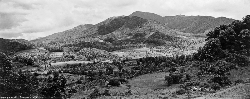
Clingmans Dome around 1940 © Knox County Public Library
The photo above was taken by Knoxville, TN photographer Jim Thompson. It shows the parking area at Clingmans Dome sometime around 1940.
At an elevation of 6,643 feet, Clingmans Dome is the highest of the Smoky Mountains and the highest point in the state of Tennessee. It is also the highest point along the 2,174-mile Appalachian Trail. East of the Mississippi River, only Mt. Mitchell in North Carolina is higher, and only by 39 feet. Clingmans Dome has two subpeaks: 6,560-foot Mt. Buckley to the west and 6,400-foot Mt. Love to the east.
The Cherokee called this mountain Kuwahi, and later settlers called it Smoky Dome. In 1859 surveyor Arnold Guyot renamed the mountain for his compatriot Thomas Lanier Clingman, a Civil War general who explored the area in the 1850s.
Historical photograph used with permission of C.M. McClung Historical Collection, Knox County Public Library
I love Jim Thompson’s photos of the Smokies! Just one edit to suggest – current US Geographic Survey records list Mt. Craig, adjacent to Mt. Mitchell in the Black Mountains of WNC, as the second highest peak at 6647 ft. Clingman’s Dome is third at 6643 and Mt. Guyot is fourth at 6621 ft. Balsam Cone, also in the Black Mts., rounds out the top five at 6611 ft. http://americasroof.com/6000.shtml