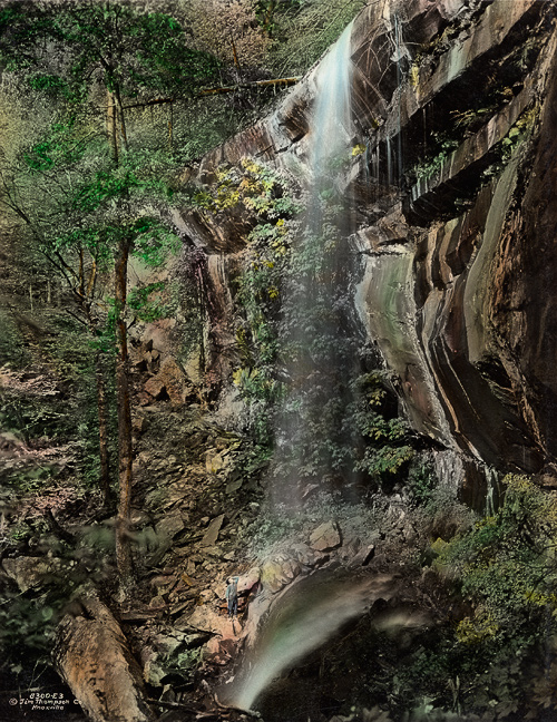
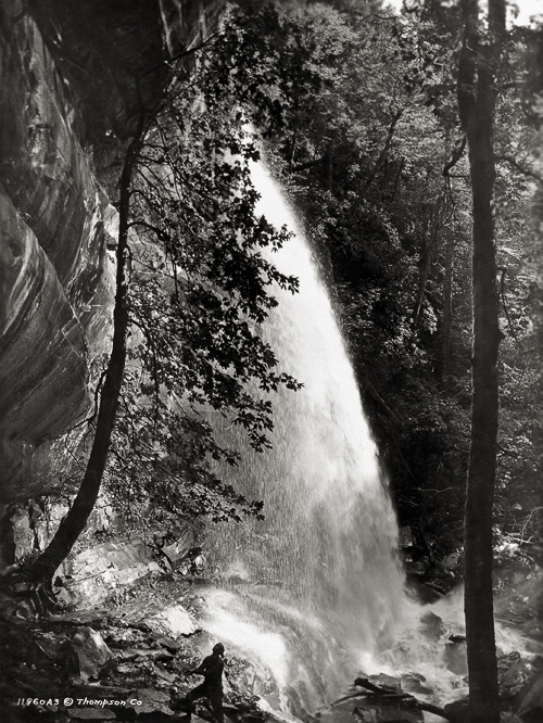
Rainbow Falls has been a popular Smokies hiking destination since long before the formation of the National Park. LeConte Creek plunges near 80 feet over a massive cliff face that Harvey Broome called an “ethereal diorama,” creating the highest single-drop waterfall in the Smokies. The photos on this page were taken by Knoxville photographer Jim Thompson at various times in the 1920s and 1930s.
The trailhead to the waterfall is located on Cherokee Orchard Road, at the start of the Roaring Fork Motor Trail, just outside Gatlinburg. For most of the 2.6 mile route to Rainbow Falls, you will have LeConte Creek as your companion. It’s a steady climb as you begin the ascent of Mt. LeConte. If you follow the trail all the way to the LeConte summit, you will have gained almost 4000 feet in elevation over a 6.7 mile hike.
During the time of homesteaders, before the advent of the National Park, LeConte Creek was known as Mill Creek … so named because of nearly a dozen grist mills that supported the surrounding farming community.
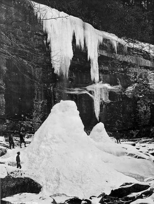
Thompson’s notes on the winter scene above: “A Wintery phenomenon at Rainbow Falls, a stalactite 24 feet long and a stalagmite 36 feet high formed on Le Conte Creek during below zero weather. A misty stream is all that is left unfrozen to fall through the cylinder opening of the formation.”
Photos used with permission of C.M. McClung Historical Collection, Knox County Public Library.
If you’re vacationing in the Smokies, please consider a visit to the William Britten Gallery, located along the historic Arts and Crafts Trail on Glades Rd. in Gatlinburg. You’ll find my complete display of Smoky Mtns photos, plus magnets, notecards and mugs.

I love the old photos…thanks for sharing!